Pasture data collection tools and GIS-based tools for spatial analysis
Check out the details of the different technologies developed for pasture data collection and spatial analysis
Technology
Pasture data collection tools and GIS-based spatial analysis allow farmers to monitor the spatial and temporal variability of forage resources and grazing systems. These data help optimize pasture management by identifying differences in biomass availability, vegetation vigor, and grazing pressure across paddocks. Combined with geospatial analysis, farmers can define management zones and monitor changes over time, improving forage use efficiency, guiding grazing distribution, and supporting more sustainable and informed livestock management.
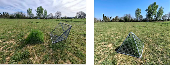
In this study, a combination of field-based tools and spatial technologies was used to monitor small ruminants on pasture.
Grasshopper
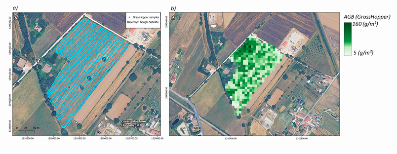
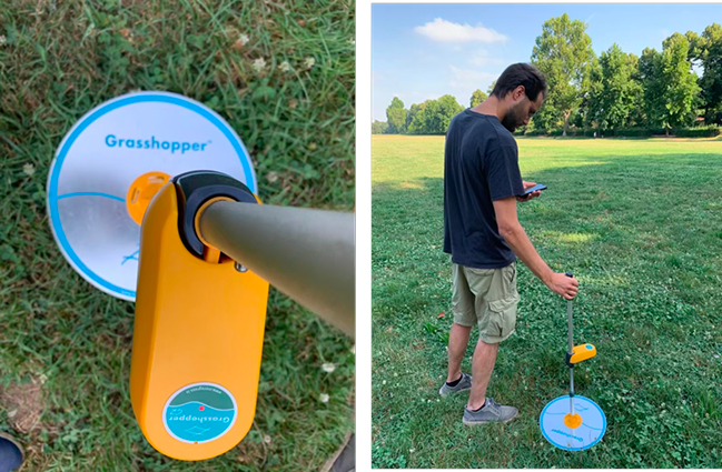
The height of grass is strongly related to the amount of forage biomass present in pastures. The GrassHopper is a semi-automatic rising plate meter that allows to take multiple height reads in a very short time. The readings can be viewed from a dedicated app on the phone. Furthermore, a GPS point is recorded every time the instrument takes a measurement, allowing to define specific paddocks to be monitored. The Grasshopper is a quick, reliable way to monitor grass growth, making it easier to plan grazing rotation and optimize forage use over time.
Grassmaster
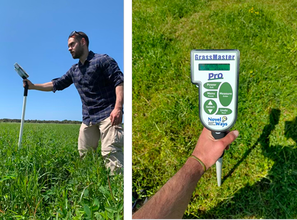
The grass master is a high-tech tool that estimates grass dry biomass, a key factor for determining a correct stocking rate. Its functioning relies on changes in electrical conductance caused by the grass, which are converted into kg/ha of dry biomass and can be read from the screen. Compared to traditional destructive sampling, the Grassmaster offer a faster and less labour-intensive way to assess pasture conditions.
Remote sensing for pasture management
Satellite imagery offers the possibility to have updated information on pastures status across both space and time. The functioning relies on the relationship between the recorded spectral signal in the visible and near-infrared channels with properties of the grassland (e.g., dry forage biomass). An assessment over large areas and at different moments of the season can be performed using publicly available data, such as the Sentinel-2 constellation from the European Space Agency (ESA), which offers 10 m spatial resolution and a 5 days revisit time. Hence, remote sensing enables grazing management to be tailored according to the varying productivity status of pastures.
Forage biomass modelling
Knowing the availability of forage biomass over large areas is a crucial information to determine the correct stocking rate, contributing the productivity of farms as well as to the long-term preservation of pasture areas. By integrating meteorological and satellite inputs, the Grassvistock model (Leolini et al., 2025) can reproduce the dynamics of biomass accumulation at a daily timestep, providing a key tool for pastures’ management.